GEOTECHNICAL ENGINEERING
MEMPHIS
HomeExcavationsGeotechnical excavation monitoring

Geotechnical Excavation Monitoring in Memphis, TN

Technical studies that support your project.

LEARN MORE

You cannot manage what you do not measure, and in Memphis that starts with understanding the ground before you dig. The city sits on a complex stratigraphy of Pleistocene loess overlying the Jackson Formation, where saturated silt layers can lose strength without warning during dewatering. We deliver geotechnical excavation monitoring that tracks lateral deformation, settlement behind shoring, and piezometric pressures throughout the construction cycle, giving the project team data they can act on before a small movement becomes a costly delay. A well-instrumented site in the Poplar Avenue corridor or near the Wolf River floodplain requires careful sensor placement, and we often recommend coupling inclinometer arrays with a targeted CPT test program to refine the subsurface model before installing monitoring points. The goal is straightforward: protect the excavation, the adjacent structures, and the crews working at depth.

In Memphis loess, the window between stable cut and sloughing face is often a matter of hours after a rain event, making automated monitoring a non-negotiable line of defense.
Our service areas

Scope of work

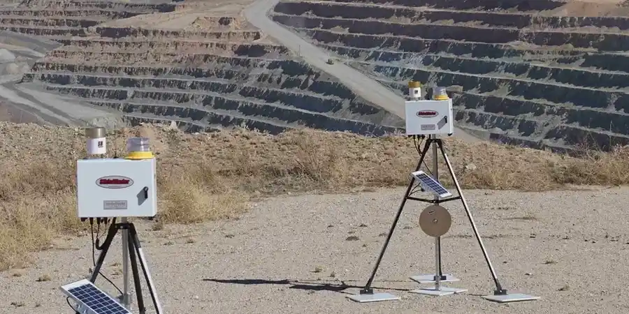
At an elevation of roughly 337 feet above sea level, Memphis is far enough from the Mississippi River channel to avoid daily flooding, yet the water table in the alluvial and loess deposits east of downtown often sits just 15 to 25 feet below grade. That shallow groundwater makes excavation monitoring a different challenge here compared to the bedrock-controlled sites in Middle Tennessee. Our field crews install automated total stations, tiltmeters, and vibrating-wire piezometers on a project-specific grid, sampling at intervals tight enough to catch the onset of basal heave or shoring deflection. The data feeds into a cloud dashboard that the superintendent and the geotechnical engineer review together, and we correlate real-time readings with the laboratory index properties obtained through grain size analysis, because silt-rich loess responds to moisture in ways that clay-dominated profiles do not. For deeper cuts where the excavation approaches the stiff clays of the Jackson Formation, we frequently integrate the monitoring plan with deep excavations design reviews to confirm that the shoring stiffness assumptions match the actual ground behavior observed in the inclinometers.
Geotechnical Excavation Monitoring in Memphis, TN
Technical reference — Memphis

Area-specific notes

The variable cementation of Memphis loess, occasionally strong enough to remain vertical for days, fosters an unrealistic confidence that only instrumented data can correct. During the post-World War II expansion, the city grew eastward, creating a mix of mid-century masonry structures and newer steel-frame buildings resting on shallow foundations within the loess belt. When deep excavation occurs near these aged buildings, the potential for differential settlement escalates rapidly, particularly where deteriorated sewer laterals have leaked and locally moistened the silt. A 30-foot excavation once caused minor cracking in a brick-clad building 60 feet away, solely because the contractor failed to account for horizontal stress relief in the dry loess. A monitoring scheme that integrates surface settlement monuments with in-inclinometer shape arrays is essential in this setting; it distinguishes between a manageable remediation and a crisis shoring fix that can halt site operations for weeks.

Need a geotechnical assessment?

Reply within 24h.

Email: contact@geotechnicalengineering1.org

Standards used


Applicable codes and standards for monitoring include ASTM D6230-13 (Standard Practice for Monitoring Well or Piezometer Installation), IBC 2021 Section 3304 (Excavation and Monitoring Requirements), ASCE 7-22 Chapter 35 (Temporary Works and Monitoring), and OSHA 29 CFR 1926 Subpart P (Excavations, requiring a competent person).

Reference parameters

ParameterTypical value
Lateral deformation threshold (alert level)0.25 in. cumulative / 0.05 in. per 24 h
Settlement behind shoring (trigger)0.5 in. total per IBC Table 1804.1 guidance
Piezometric pressure change (warning)±2 ft head variation from baseline in 48 h
Inclinometer casing depth10 ft below lowest excavation grade or into Jackson Fm.
Crack meter resolution0.01 in. on adjacent structures within 2H influence zone
Reporting frequency (active phase)Daily summary with real-time alerts on exceedance
Baseline survey datumNAVD 88, tied to local benchmarks outside zone of influence

Top questions


What triggers an alert in a Memphis excavation monitoring plan?

During the design phase, we set project-specific thresholds, but typical Memphis alert levels are: cumulative lateral shoring face movement of 0.25 inches, settlement behind the wall exceeding 0.5 inches, or a piezometric head change greater than 2 feet within 48 hours. Alert notifications are sent via SMS and email within minutes of an exceedance; any red-level trigger prompts a direct call to the engineer of record.

How much does geotechnical excavation monitoring cost for a typical Memphis project?

The monitoring scope varies with excavation depth, footprint, and adjacent structures, but most Memphis projects fall between US$830 and US$2,450 per month of active monitoring. This covers instrument rental, data collection, daily reporting, and engineer review. A fixed-price proposal is always provided after we review the shoring plans and site constraints.

Do you monitor vibration from compaction or pile driving near existing buildings?

Yes, we install triaxial geophones on adjacent buildings and monitor peak particle velocity in real time. For the plaster and masonry common in older Memphis commercial buildings, we reference the USBM RI 8507 criteria. We coordinate with the contractor to adjust hammer energy or sequencing if vibration approaches the limit.

How long should monitoring continue after the excavation reaches final grade?

We typically recommend maintaining the monitoring program through completion of permanent ground-floor slabs and backfilling of the overexcavation zone. In Memphis loess, seasonal moisture changes can trigger delayed movement, so we often keep inclinometers active for four to six weeks after the shoring is fully loaded to confirm deformation rates have dropped to near zero before demobilizing.

Location and service area

We serve projects across Memphis and surrounding areas.

View larger map